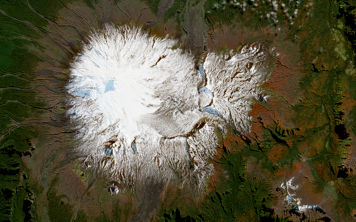
Villarrica Volcano is located in southern Chile, specifically within the communes of Villarrica, Pucón, and Panguipulli. It stands at 2,847 metres above sea level, with a basal area of 400 km² and an estimated volume of 250 km³. It is one of the most active volcanoes in South America and ranks first on the risk index compiled by the Chilean National Geology and Mining Service (Sernageomin), the state agency responsible for volcanic monitoring, among other functions.
Villarrica is a stratovolcano—a tall, conical volcano formed by successive layers of hardened lava and volcanic material.
In the 21st century, it has experienced one major eruption, which occurred on 3 March 2015. Although it lasted only 16 minutes, it was enough to produce lava fountains, lahars (volcanic mudflows), and mixed avalanches, causing material damage in the surrounding areas.
Originally, the volcano was known as Ruka Pillán by the Mapuche people, the largest Indigenous group in Chile. In their ancestral language, Mapudungun, the name means “the dwelling of the spirit” or “house of spirits”.
The image was captured by the Sentinel-2 satellite on 4 May 2025. It uses true colour bands (red, green, and blue) to depict the Earth as it would appear to the human eye, with slight enhancements in contrast and saturation for clarity.
Image credits: Data Space Copernicus.
Information source: Chilean National Geology and Mining Service (Sernageomin).