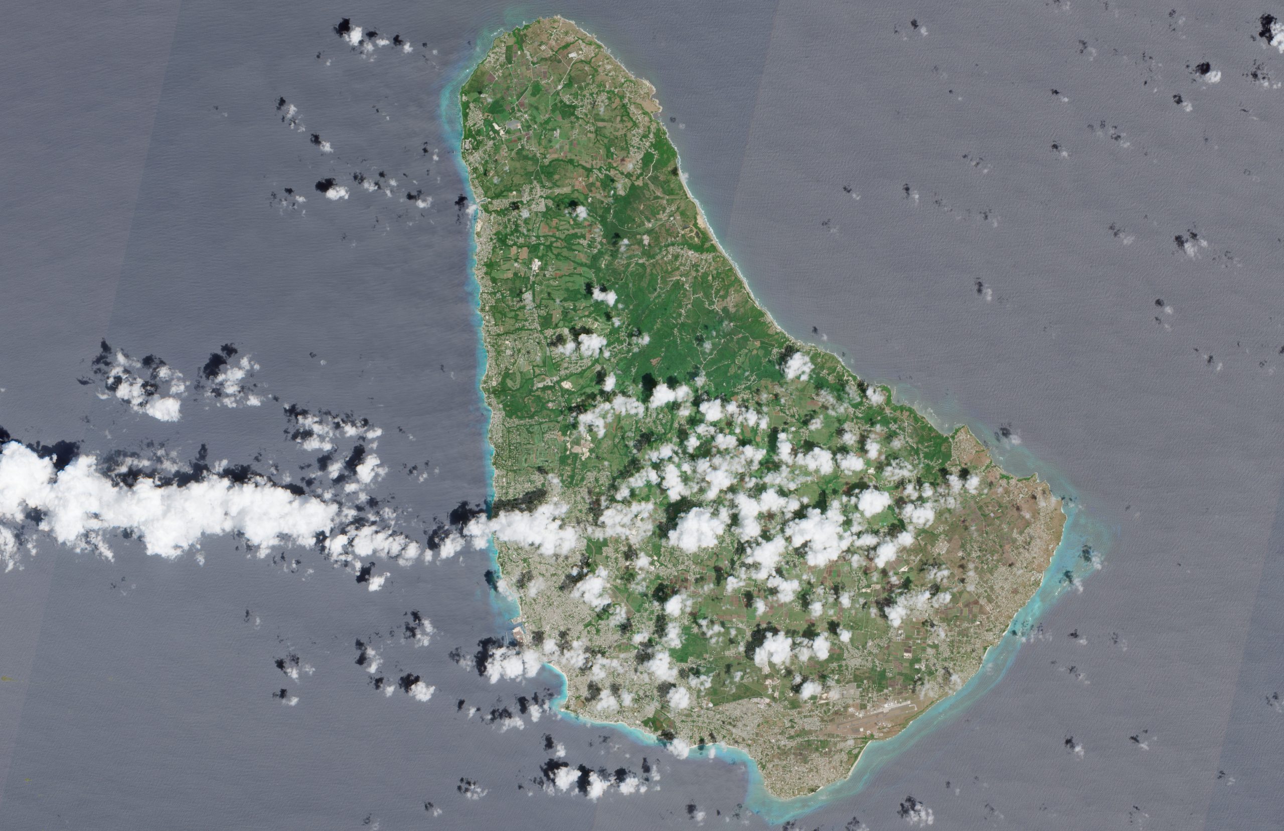
Barbados is an island country located at the easternmost edge of the Caribbean, within the arc of the Lesser Antilles. Measuring 34 kilometres in length and 23 kilometres in width, it was formed from ancient coral reefs and marine deposits that gave rise to limestone soils. This geological condition accounts for the abundance of white sandy beaches and the reefs that fringe its coastline, as well as its tropical climate with well-defined dry and wet seasons. The highest point is Mount Hillaby, which rises 340 metres above sea level.
The territory hosts rich terrestrial and marine biodiversity. Its reefs provide habitat for numerous species, while on land tropical vegetation is interspersed with cultivated areas. Bridgetown, the capital, has been recognised as a UNESCO World Heritage Site for its historical and cultural importance. It is home to a large proportion of the country’s nearly 280,000 inhabitants and serves as the island’s political, economic, and cultural centre.
The image was captured by the Sentinel-2 satellite on 29 September 2025. It was composed using visible light bands — red, green, and blue — which render the Earth’s surface in colours very similar to those perceived by the human eye. To aid interpretation, atmospheric corrections and contrast enhancements have been applied, highlighting details in the vegetation, the sea, and urban areas.