The Paraguay River, with a length of approximately 2,695 km, is one of the main rivers that form the La Plata Basin.
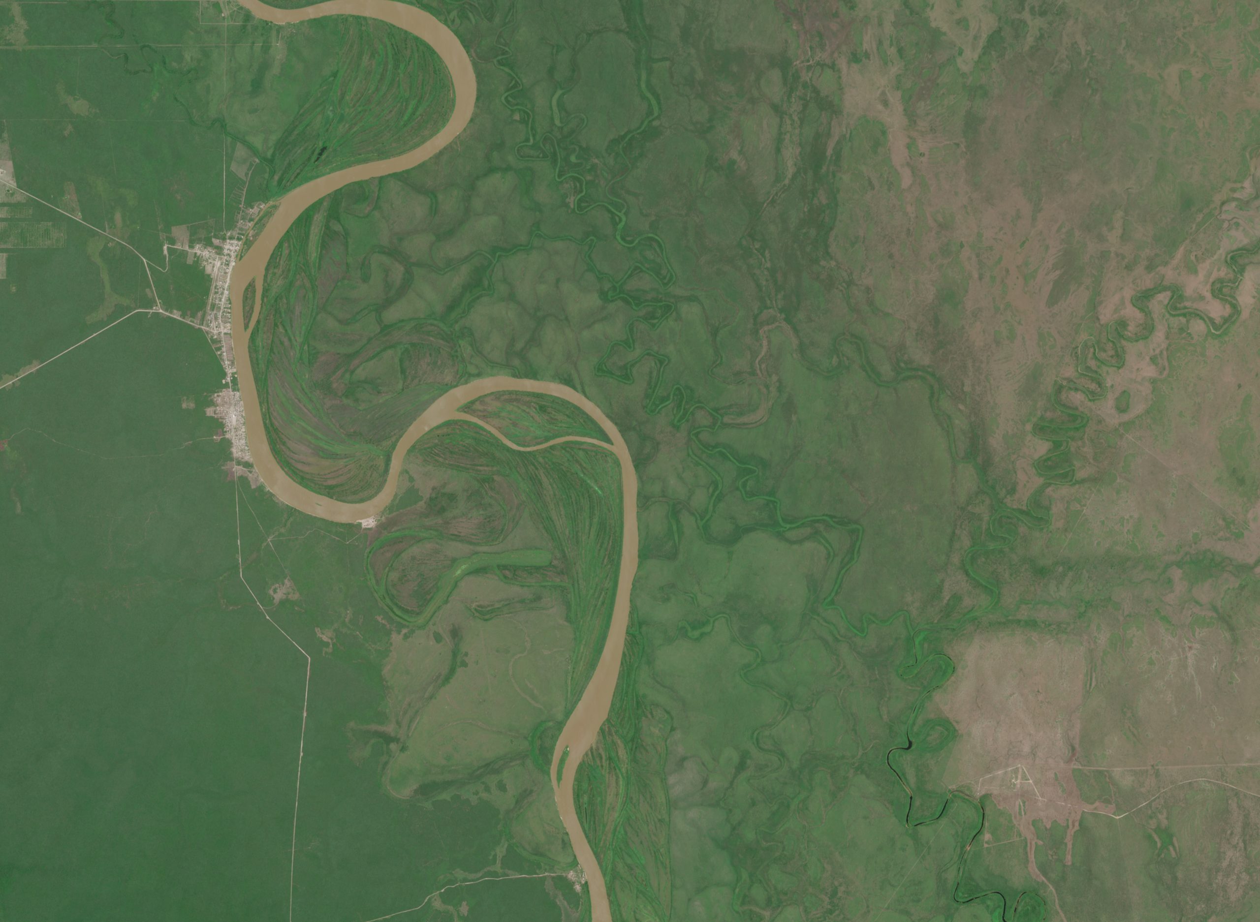
In the satellite image, a stretch of the Paraguay River can be seen with large natural bends, known as meanders. These curves form as a result of the slow movement of water over time. The river’s light colour is due to the presence of suspended sediments, that is, soil particles carried and kept mixed within the water.
Surrounding the main channel are low-lying areas that are periodically flooded, along with former river courses and small secondary channels. These appear as darker, winding shapes and show how the river changes and shifts over the years, especially during seasonal floods. The vegetation is not uniform: it is denser in the lower, wetter areas and sparser or drier in the higher sectors.
In this section, the river -known in Guarani as Ysyry Paraguái- serves as a natural border between Paraguay and Brazil. On the western side, the city of Bahía Negra can be identified, visible through its orderly street layout and its location directly linked to the river, which plays a central role in the life and connectivity of the settlement.
The image was captured by the Sentinel-2 satellite on 5 January 2026 and obtained through the Copernicus Data Space.