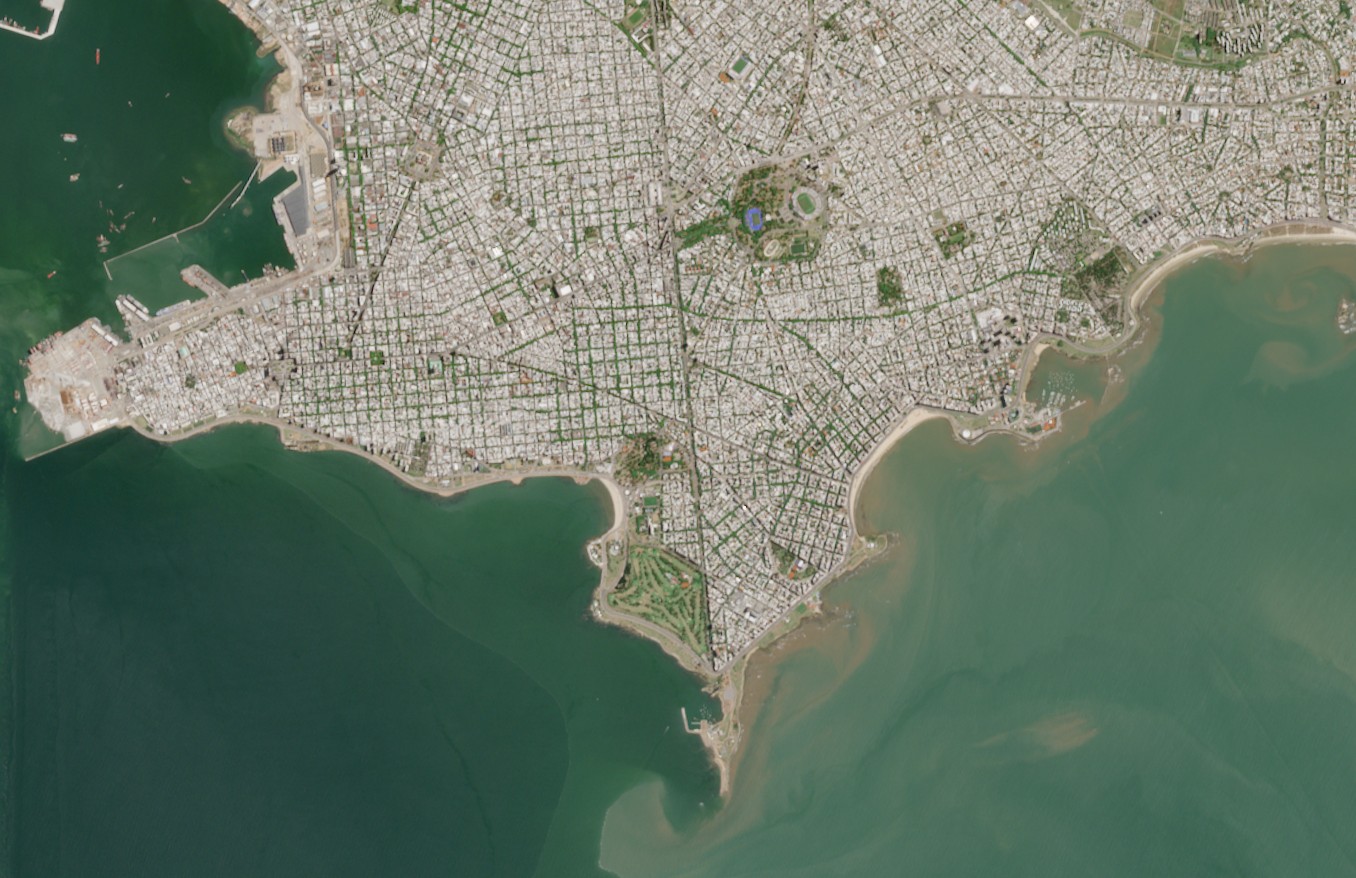
Montevideo is the capital of Uruguay and the southernmost metropolis in America. It is located on the northern shore of the Río de la Plata, a vast estuary that washes its coasts. From a satellite view, the urban layout can be seen extending eastwards from the peninsula, with residential neighbourhoods and beaches lining the coastal avenue, which stretches for more than twenty kilometres. The city combines densely built-up areas with parks, industrial zones and the port, shaping a landscape where urban infrastructure is organised in close connection with the river.
The image corresponds to a capture from the Sentinel-2 satellite taken on 13 February 2025. It shows the continuity between the urban fabric and the coastal front, together with the distribution of green spaces and built-up areas. The coastal strip of Montevideo can also be seen, characterised by its inset beaches and by the sediment plumes carried by the Río de la Plata. This type of satellite record is essential for describing the territorial configuration of the city and its ongoing interaction with the estuary.