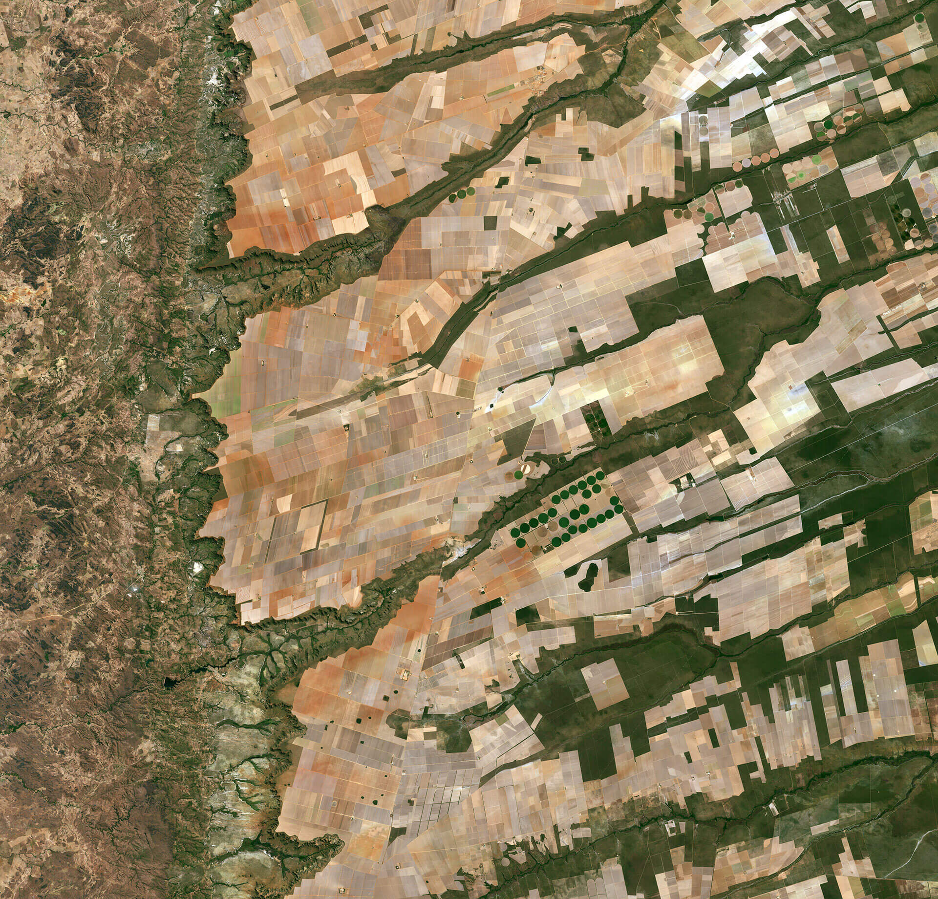
Sentinel-2A takes us to the central-eastern part of Brazil – more specifically where we are in the states of Bahia, Tocantins and Goiás.
Here we can see a large and flat plateau, without fields, benefiting from rich soils and an apparent abundance of water, before falling into a green and undulating valley (to the left). The lines run in the image on the roads, like the road that runs on a line that runs from the center-top to the bottom of the image.
The area is particularly well-known for soybean production. Soybean production in the country has increased more than 3000% since the 1970s and Brazil is the world’s second largest producer of soybeans, after the USA.
Other plantings in this area include millet, coffee and cotton.
A distinctive feature in this image is the circles – mainly in the center. These forms are bred by a central-pivô irrigation system, where a long water tube rotates around a well in the center of each plot. These varied cores show different types of cultures, or different phases of growth.
The two Sentinel-2 satellites were designed to monitor changes not only, including the type of color and robustness. While the first satellite has been in orbit since 2015, its twin Sentinel-2B was launched on March 7. Together, the satellites will provide new images of the surfaces of only Earth every five days.
This image, also displayed in the Terra video program from Space, was obtained by the Copernicus Sentinel-2A satellite on August 8, 2016.
Source: ESA