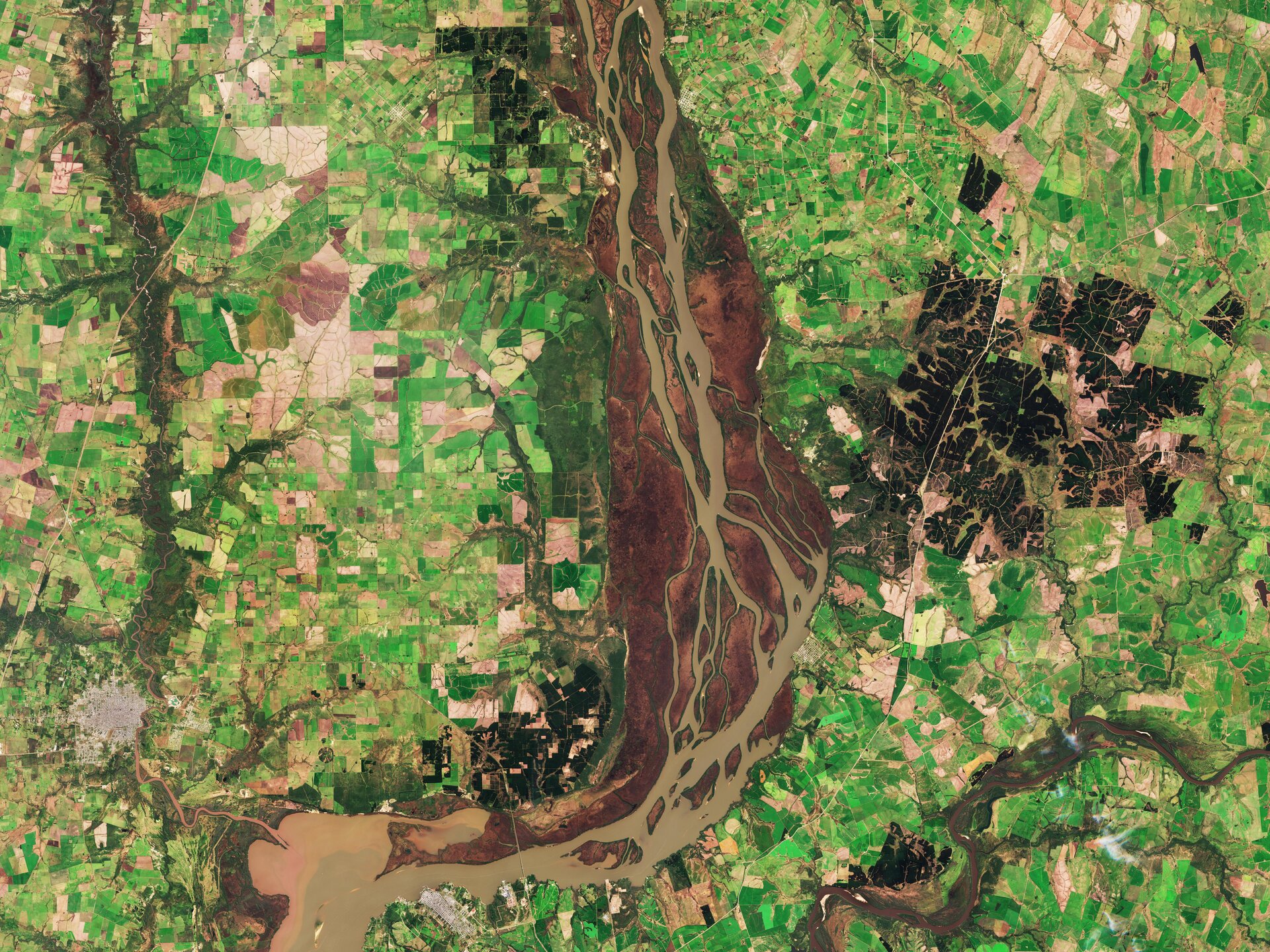
The Copernicus Sentinel-2B satellite today takes us to the lower Uruguay River. Here, this brown, sediment-rich river forms the border between Argentina and Uruguay, and is home to the wetlands of Esteros de Farrapos and Islas del Río Uruguay.
Made up of lakes, wetlands and 24 islets, the Esteros area is a haven for wildlife, protected by a national park and included in the Ramsar Convention’s List of Wetlands of International Importance.
It is home to 130 species of fish, 14 species of amphibians, 104 species of birds – a quarter of all birds in Uruguay – and 15 species of mammals, including the aguará guazú, or maned wolf, the largest of South America’s canids.
The estuaries are a tourist attraction and a water transport route, and play an important role in regulating flood levels and water quality, as well as protecting the banks of the Uruguay River from erosion.
In the lower left part of the image, the buildings shown in light grey correspond to the Argentinean city of Gualeguaychú. On the eastern bank of the river we see the Uruguayan town of Fray Bentos, an important port enclave, famous for a plant that once exported corned beef to the world. This industrial complex, now inactive, is a UNESCO World Heritage Site.
The dark green area east of the Parque de los Esteros is dedicated to forestry, a key sector for the region. A pulp mill is located near Fray Bentos.
Sentinel-2 is a two-satellite mission providing coverage and data for the European environmental monitoring programme Copernicus. The mission’s main instrument has 13 spectral bands and is designed to provide images to distinguish vegetation types and monitor plant growth.